Royal Burgh of Lochmaben Town Trail

Lochmaben became a Royal Burgh in 1447 but the charter was destroyed during the border wars. It was renewed by King James VI in 1612. Human habitation in the area was known to be present long before this as a crannog, or lake dwelling, was discovered in Castle Loch one hundred and fifty years ago. Its timbers have been dated to AD 630. The first mention of Lochmaben in documented history occurs in 1166 when William the Lion granted a charter to Robert Bruce, Earl of Annandale.
The map shows the location of the places on the Town Trail, complementing this is an interactive map and a 360° panorama to explore.
Acknowledgements
A special thanks to the members of the former Lochmaben Initiative who prepared the original leaflet available at the Town Hall particularly Paul Roxburgh for the fine drawings except the old Primary School by Rebecca Gow and Marjorie Banks by Robert Togneri, Text by Isabelle and Paul Gow, Tom Russell, and David Mair.
References
1897 Lochmaben Almanac
Two books by John B Wilson MD: “The Royal Burgh of Lochmaben” 2nd Edition first pub 2001 “Further Glimpses into Lochmaben’s History” first pub 2009
A book by Isabelle C Gow “A Guid Wee Schule – a history of Lochmaben Primary School” first pub 2005
Lochmaben Heritage Centre
located within the Town Hall for more
open Monday, Wednesday or Friday 2 pm to 4 pm
Contact to confirm times
Start the trail here…

1 – Town Hall
The statue of the Reverend William Graham replaced a statue nicknamed “Flora MacDonald” but was most likely a statue dedicated to St Magdalene. On the wall of the Hall is a plaque commemorating William Paterson of Skipmyre (near Lochmaben) who founded the Bank of England. In front is the statue of Robert the Bruce.
There was a Tollbooth in 1563, but it was replaced by the Town Hall in 1723. This building was enlarged in the 1860s and two stained glass windows depicting Bruce and Wallace were added in the Upper Hall.

2 St Margaret’s
The flats are built on the grounds of St Margaret’s Church (1920-1957). Part of the hall can still be seen. Several buildings in Queen Street (formerly East Street) housed old shops. An almanac of 1897 listed 9 grocers, 3 bakers, 3 butchers as well as several other commercial businesses in the Burgh.

3 Dolphin Cottage
Dolphin Cottage was the site of a gas works built in the town after the arrival of the railway. Immediately to the east of it, where the house ‘Lenamhor‘ stands, was the corn mill until about 1900. The mill, powered by water from the Mill Loch through a mill lade controlled by a cast iron Victorian sluice gate, is now culverted from the Mill Loch to the edge of the built-up area.
Read more …
4 Railway station and goods’ yard
The Caledonian Railway branch line transported Lochmaben passengers and goods to Dumfries or Lockerbie from 1863 until 1952 and goods until 1965.
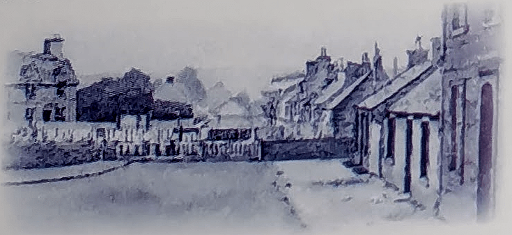
5 The Barras
is the site of a medieval jousting area. In the 1940s and 50s, the Barras United Presbetyrian Church (1813-1920) in Church Crescent was used as a cinema. This shows the current manse and the Barras Church as they would have looked.
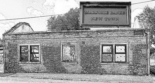
6 Marjoriebanks
known locally as the “Bogle Hole” was named after Bruce’s daughter, Marjorie, and was once well-known for poachers. A plaque on an old cottage is inscribed “Marjorie Banks New Town” (1851) and is the former home of the warden of the Poorhouse which existed until the mid-20th century.
Read more …
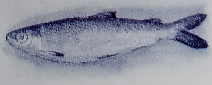
7 The Mill Loch
was the home of the famous Vendace fish last caught there in 1966., a specimen can be seen in Dumfries Museum.
On a clear day, you can also see the site of an Iron Age fort – Woody Castle. There is a picturesque walk around this loch and free fishing is available for visitors.
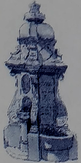
8 The Coronation Fountain
originally sited in front of the Town Hall, was erected in 1911 to the memory of King Edward VII by a sister of the Laird of Halleaths.
9 A knitwear factory
House No 51 to 55 on Princes Street (formerly West Street) was where a knitwear factory was located after 1881.
It was owned by J & D McGeorge’s of Dumfries as an expansion of his business. Socks produced here were once supplied tothe Prince of Wales – later King Edward VIII. It closed in the late 1970s.

10 Mercat Cross
In the garden next to the Church Hall, which is Common Land, is the Mercat Cross. It was originally sited in front of the Town Hall. The shaft of the cross is oblong in section with splayed edges.
The whole is crowned by a circular neck supporting an arrangement of sundials on all four sides with a ball on top – this section is dated 1729. Only the north and south sides feature a gnomon.
Read more …

11 Magdalene House
In Bruce Street (formerly Braegate) is (St.) Magdalene House. Originally a church manse, the house was named after the patron saint of the town.
It was in this Manse that Robert Burns wrote “The Blue Eyed Lass” after spending the evening with the minister and his family, including the 15-year-old Jeannie Jaffray.
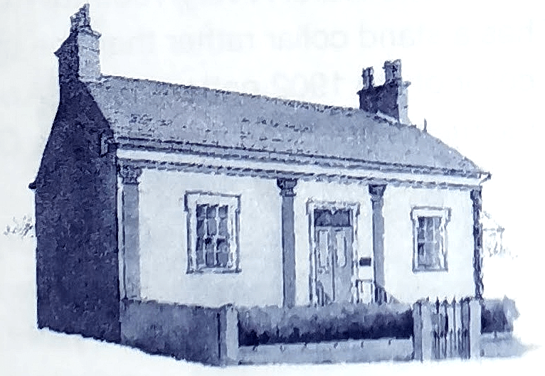
12 Old Bank House
One of the oldest existing houses in the Burgh, built in 1703, is called “Old Bank House” and accommodated the National Bank and the Lochmaben District Savings Bank.

13 The Kirk Loch
It is bounded by the Burgh’s attractive 18-hole golf course and a popular caravan park from where paths are accessible along the loch.
Free fishing is available from the caravan park.
The Curling Hut is a reminder of the past when the frozen loch was used for outdoor bonspiels
14 Site of Bruce’s Castle
A 12th-century motte and bailey castle of wooden construction originally stood on what is now the second green of the golf course.
The Bruce family became Lords of Annandale in 1124. It is claimed that King Robert I of Scotland (Bruce) was born there, which is why the town adopted the motto “From us is born the liberator king” (in Latin) on its coat of arms.
Read more …
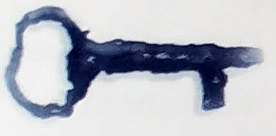
A 13th-century key found on the site is displayed in the Clubhouse.
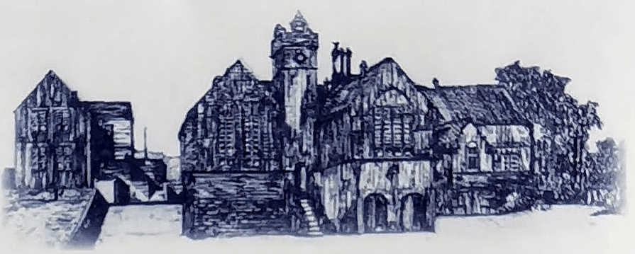
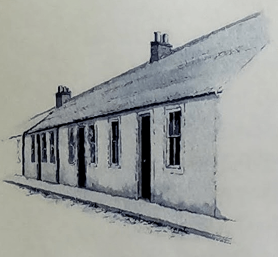
15 Site of Lochmaben Public School
A collection of fine red sandstone buildings, many of which have survived, formed the school which educated pupils from the parish for over 100 years until the new Primary School was opened in 1983.

16 Lochmaben Church
“Mr Glover’s Schoolhouse” was situated where Lochmaben Church of Scotland now stands.
The church was built between 1818 and 1821. In the belfry are two of Scotland’s oldest working bells the Pope’s Bell and the 14th-century Bruce Bell.
Upstairs in the church, there still exist old “named” pews where the local farming families, their employees and heritors would sit on Sundays.
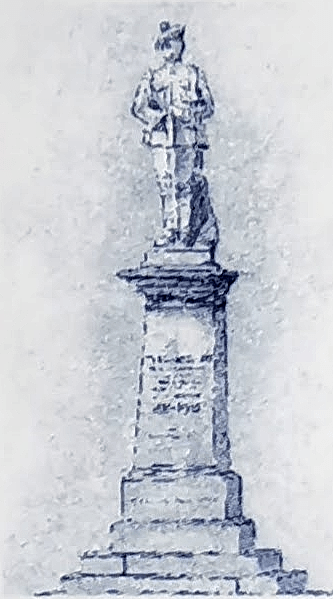
17 The War Memorial
is dedicated to those from the Parish of Lochmaben who died in the two World Wars.
A very youthful KOSB statue has a stand collar rather than the stand and fall collar of the 1902 pattern tunic. A wide variety of regiments are listed including the Ghurkas.

18 Victory Park
is an ideal viewing point for the Castle Loch and yacht club. There are tennis courts and a bowling green accessible from Annan Road.
At the corner of the Bowling Green next to the Loch was the site of the Boating House and jetty. The House was burned down in 1952. Fishing for visitors requires a permit.
Beyond the Bowling Green is the woodland path along the Castle Loch leading to the medieval Lochmaben Castle, a mile and a half away.
The Castle Loch is a Ramsar site, a wetland of international importance. It is an important bird-watching area and is internationally famous for pink-footed geese.
Victory Park is part of Lochmabens Common Land
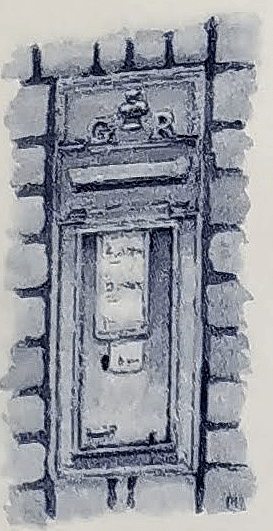
19 The High Street
A fine example of a broad market street including a George V post box, set in the wall and still in use.
Opposite the post box and behind the Doctor’s Surgery is the new Primary School and Lochmaben Centre which offers a range of activities for all ages.
Beside them is the drained Grummel Loch now used as a recreation area. Close by were the old playing fields – the venue for the Lochmaben Games which included horse racing, running and Highland dancing.
Also on the High Street are the old Schoolhouse and the Freemasons’ Hall which houses the town library.
20 Old Churchyard
Access is up the lane at the King’s Arms.
A church (St Magdalenes), founded in 1170 by Robert the Bruce, was sited there.
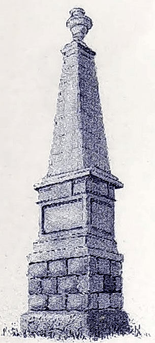
The churchyard contains an obelisk to the memory of Dr. James Mounsey who was a physician to the Empress Elizabeth of Russia and is credited with bringing rhubarb seeds to Britain and promoting the health benefits of eating it.
Another monument stands in memory of Dr. William Jardine, a founder of the Jardine-Matheson Trading Company.
The map is fully interactive, you can zoom in/out and scroll the map in any direction. It can be opened full screen and you can choose different styles of map – the default map is an Ordnance Survey Map from 1888
Below is a 360° panoramic view from above the Town Hall, looking East towards Grummel Park – use a mouse or finger to explore