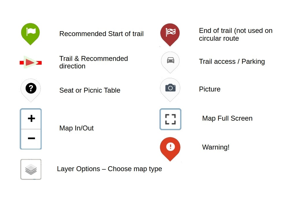
Below is a maps of walk of a walk around Hallheaths, these walks are relatively easy to do with an alternative options to shorten the route. Please have a look at the guide,
Using the Map
, for the symbols on the map before using.
Timings for the walks have been calculated in Kilometres loosely based on
Naismith's Rule
with speed of 4 Km / hour.
| Explanations → | Using the Map | Naismith's Rule |
Walk Description
This is a circular walk and is mainly on quiet roads outside Lochmaben. This walk is described as going clockwise. It can be shortened by doing a “half circuit” and returning to Lochmaben through fields this is described after the full walk – this is shown in a Blue Line on the map
To the right of the Town Hall walk along Queen Street and Townhead for 500 m to reach the Mill Loch on the left.
Continue straight ahead on the road, passing Barras and then Marjoriebanks and reach a road junction on the edge of the village.
Turn right onto Broomhill Road with some bungalows on the left. Continue on this road for about 2.2 km from the road junction until reaching the farm buildings on the right – Hallheaths Home Farm. Just beyond Home Farm at a magnificent Quercus Oak tree, a road goes left beside a new house and past a stable block now converted into houses.
Home Farm, the stables and the ruined garden opposite them were part of Hallheaths Estate. The house is sited on the flat land on the right after the walled garden. It was demolished after the war. Behind the house, there was a Prisoner Of War camp during/after World War 2. Soldiers based at Hallheaths camp carried out army manoeuvres in the streets of Lochmaben and practised for the D-Day landings on the local lochs.
The road becomes a rough track and very shortly reaches the River Annan on the left. Continue on the track which swings right away from the river and passes a bungalow, a lorry park and then a tile factory, reaching the original road from Lochmaben. At the crossroads here continue straight ahead passing Innerfield Farm.
The road turns left over a bridge over the now dismantled Lockerbie-Dumfries railway line and descends to join the main A709 Lochmaben-Lockerbie road.
The railway was originally part of the Caledonian Railway and was opened in 1863. Sadly the line was axed by Dr Beeching and closed in 1965. Milk was transported from Lochmaben to Edinburgh by rail to supply the Edinburgh Dumfriesshire Dairies. In the city, the deliveries were by horse-drawn floats or latterly electric float lorries.
Bear right and follow the main road into Lochmaben.
To shorten this walk (Blue Line on the map), you can return through the fields to Lochmaben.
There is a “Public Footpath” signpost to Lochmaben on the right about 1.3 km after joining the road at Marjoriebanks and 200 m after the road passes a bungalow on the right.
This track leads through 4 fields with 5 gates–after the 2nd gate bear right to the 3rd gate and then go left up the side of a field. Next, you pass a football pitch on the right before reaching Whitehills Avenue on the edge of the Royal Burgh.
Turn left here to arrive at Stanedyke Crescent opposite Grummel Park which is the site of the now-drained Grummel Loch, continue through the park and Blacklocks Vennel Nursery on the left to reach the Town Hall.
Notes:
The track around the River Annan can be very muddy after heavy rain. This can be avoided by continuing straight ahead after passing Home Farm and on reaching the crossroads in 300 m bear right up to Innerfield Farm and Lochmaben.
The walk through the fields can also be muddy at times and also there may be cattle in the fields.
The pavement on the A709 road back into Lochmaben is narrow initially and walking in single file is recommended.
Credits: Paul Gow, Tom Russell and David Mair of the Lochmaben Initiative and Robert Togneri for editing and production
